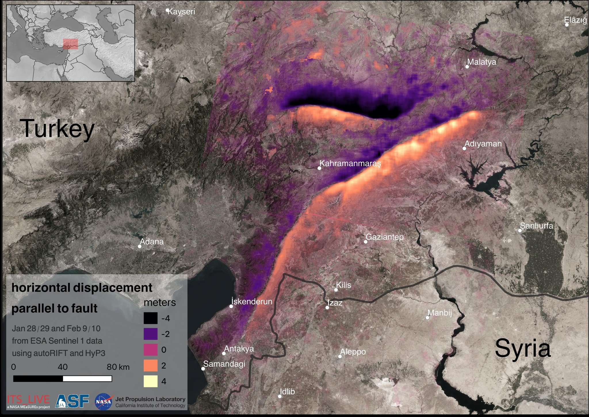
 Joseph H. Kennedy (@aJollyAdventure): "This is crazy! 🤯 We used @ASFHyP3 and AutoRIFT, the ITS_LIVE glacier tracking software, to map the displacement from the #turkeyearthquake with incredible fidelity. Graphic by Alex Gardner, @NASAJPL" | La Contre-Voie - nitter
Un post global pour le séisme en Turquie et en Syrie de cette semaine:
D'abord cette carte complètement dingue:
Le déplacement du sol, mesurée par satellite avec un logiciel de suivi de glaciers:
Une vidéo d'un champs coupé en deux par un gouffre: https://nitter.lacontrevoie.fr/yekvucutcom/status/1624092214275018752#m
Une vidéo du seisme lui-même en action: https://nitter.lacontrevoie.fr/OSPSF/status/1624048658839642114#m
Des images satellite avant/après:
une photo de la faille: https://nitter.lacontrevoie.fr/pusholder/status/1623987530612850688#m

Un photo de l'effet du déplacement de terrain sur une voie ferrée:

L'intérieur d'un batiment non-effondré:


La France, comparée à ses DROM (sans la Terre Adélie et d'autres petites îles) : france
Trop cool cette carte !
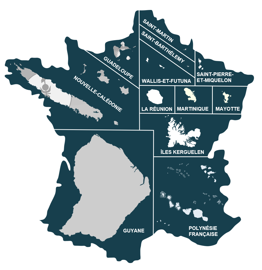
Et une annecdote marrante :
Pour l'anecdote, Maripasoula en Guyane est la plus grande commune de France (2,2 fois l'Alsace). Par contre, accès en pirogue ou avion uniquement.
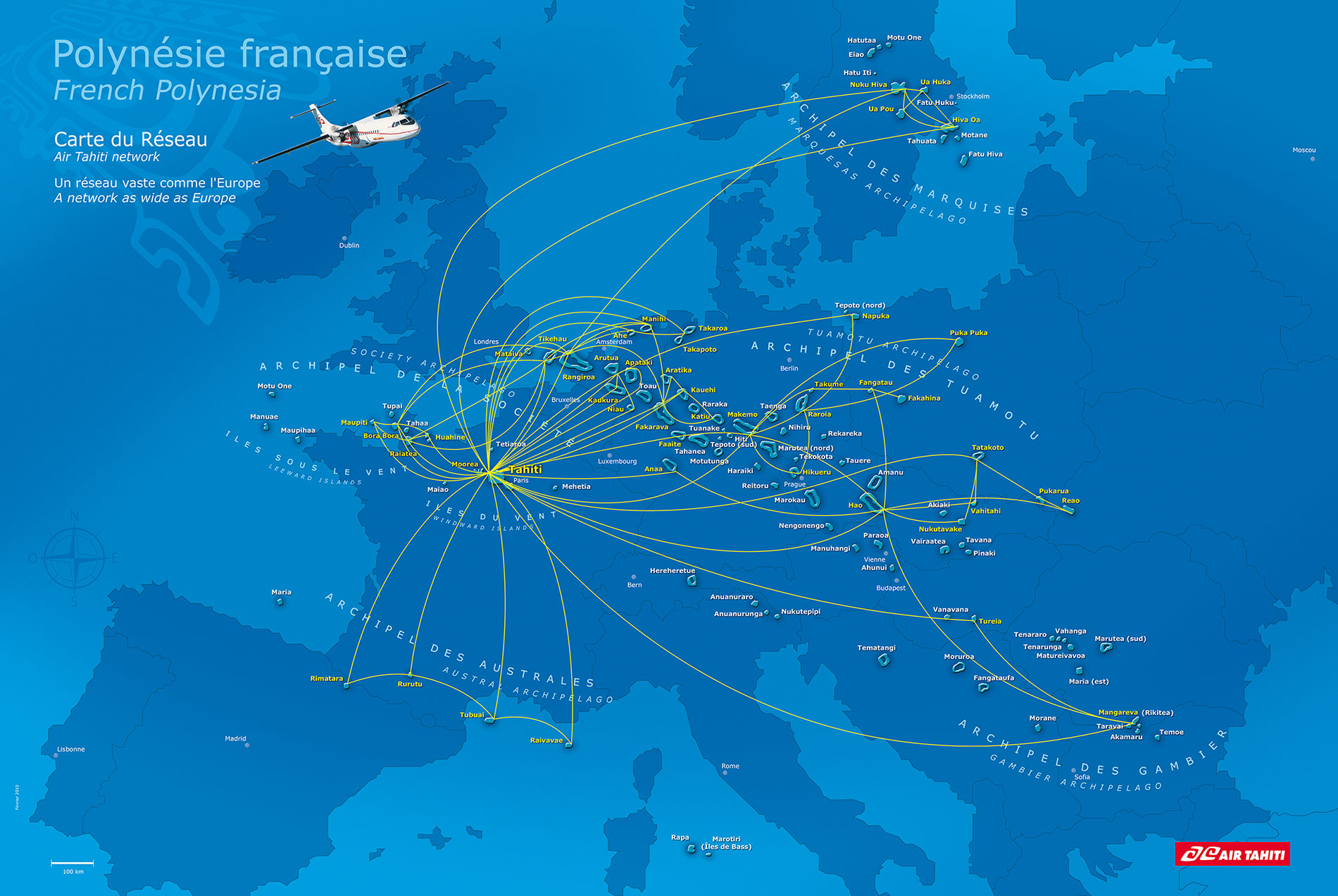
Et là surface du globe à moins de 1000km d'un territoire Français

Barracuda (@BarracudaVol1): "This line runs from Svitlodarsk to Popasna, from Popasna to Lichisank, and from Lichisank to Luhansk. Their aim is to make the south of the Donets river impassable and to hold the line along the river, Lichisank was held because it is strategically located on a high position."|La Contre-Voie - nitter
C'est encore pire que ce que je pensais, si les russes sont sérieux, ils sont en train de créer un minuscule mais très profond saillant qui contient juste Lysychansk. Saillant qu'il leur serait absolument impossible de ravitailler et de défendre efficacement en cas de pression Ukrainienne sur ce point là: c'est donc purement de la com' par quelqu'un qui n'a absolument rien à faire des aspects pratiques.


